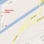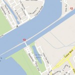
The Ballona Creek Bike Path starts at Syd Kronenthal Park in east Culver City and extends about 7 miles to the Coast Bike Path along the beach. This page details its various entrances and gives suggested approaches. Click on their names for street maps. There is some free street parking near most of the entrances, except for Lincoln Blvd (11) and Marina del Rey (12).
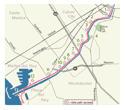
Ballona Creek bikepath map entrances
At right is a map of all entrances, starting at National Blvd (#1) and the Pacific Avenue bridge (#13); below are maps of individual entrance locations. An additional entrance (#1A) will be built at Higuera St, about half a mile south of National Blvd, and is expected to open in 2016.
Note that the bikepath entrances are locked when there is a possibility of substantial rain. During rainstorms, the creek waters become fast and dangerous and may submerge parts of the bikepath.
BALLONA CREEK BIKEWAY AND LANDSCAPING PROJECTS and SAFETY INFORMATION
When Ballona Creek was channelized starting in the 1930s, the concrete berm was nothing more than a service road for maintenance vehicles. Eventually, it was striped for public use as a bikepath and use by joggers, walkers and skaters. Significant bike path improvements in recent years include native landscaping, artist-designed gates, benches, drinking fountains, murals and other projects by public agencies and local non-profit organizations, including BCR. This continuing process is creating a pleasant recreational facility for riders, walkers, joggers and skaters, including families, and is also used by some to commute to work by bike.
With the improvements and increased ridership, the bike path generally is an enjoyable and safe place to exercise, commute, and ride to the coast, school, or other destinations. However, with limited visibility under the freeways and few entrances and exits, it is always a good idea to be alert to your surroundings. Cell phones are a good and quick way to report hazardous debris or conditions, graffiti, pollution, or suspicious behavior.
As you ride, walk, or skate on the Ballona Trail, please use extra caution, especially around the underpasses and ramps where cyclists often ride fast.
Culver City Police Department Non-Emergency Line: 310-837-1221
LAPD Non-Emergency Line: 310-202-4502
Culver City Graffiti Hotline: 310-253-5555
Handicap access information. Most parts of the bikepath are flat and accessible to those with disabilities or in hand-propelled or motorized wheelchairs. Some entrance gates are steep ramps which are not ADA compliant. There are also ramps, some of them steep, where the bikepath crosses under major streets about every half-mile to mile. On steep ramps there is a possibility of cyclists riding fast up or down the ramps, so exercise caution.
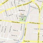
(1) Terminus at Syd Kronenthal Park (not handicap accessible).
Click to enlarge
The east end of the bikepath is most easily accessed from Syd Kronenthal Park, 3459 McManus Avenue, Culver City, a few blocks south of Washington Blvd. The bike path entrance is behind the park’s ballfield backstop. You’ll go down a steep ramp and make a u-turn onto the bike path. Before you do that, check out the colorful mural on the retaining wall behind the backstop. The Ballona Creek bikepath connects here to the Exposition light rail bikepath, which is at street level parallel to the light rail tracks.
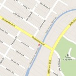
(2) Duquesne Avenue (Steep ramp, not handicap accessible)
Click to enlarge
Approachable from either Culver or Jefferson Blvd, this well-used entrance is on the downstream (west) side across the creek from Culver City’s Transportation Facility. You can’t miss BCR’s “Rivers of the World” mural on the entrance ramp or the giant urn sculpture across the creek.
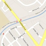
(3) Overland Avenue (ADA Accessible on west side.)
Click to enlarge
Approachable from either Culver or Jefferson Blvds, this entrance is on the west side next to the Culver City Julian Dixon Library, where you’ll see BCR’s “Postcards From Ballona” mural on the parking lot retaining wall behind the library as you enter the bike path. There is a second entrance on the east side of Overland Avenue. Limited street parking. The bikepath between Overland Ave. and Sepulveda Blvd (#5) is flat and handicap accessible.
(4) Ocean Drive and Pedestrian Bridge .

Click to enlarge
This entrance is located on Ocean Drive, which is immediately south of the creek west of Overland Avenue. Cross the creek to the bikepath via the pedestrian bridge. Handicap accessible.
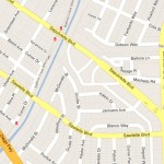
(5) Sepulveda Boulevard
Click to enlarge
There are bikepath entrances on both sides of Sepulveda Boulevard on the north side of the creek. The east-side entrance is flat all the way to Overland Ave. The west side entrance is flat for just a short distance, then meets a steep ramp.

Click to enlarge
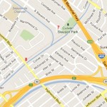
The entrance is located on tiny Culver Drive on the north side of the creek at Purdue Ave., a block west of Sawtelle Blvd. Steep ramp.
Click to enlarge
This entrance is located where Slauson Avenue dead-ends into the creek on the north side. The entrance ramp passes through a little community garden. Short but steep access ramp.
(8) Inglewood Boulevard

Click to enlarge
Entrance is on the east side of Inglewood Boulevard. Flat access ramp.
Click to enlarge
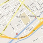
One entrance is on the west side of the street, where there is some off-street space for parking. Another entrance is on the east side of Centinela Avenue, a short distance down a small side street called Culver Drive. Flat access ramp with benches and a drinking fountain.

Click to enlarge
Reachable from Culver Blvd or Braddock Ave, this entrance is located where McConnell Ave ends at the north side of the creek. Steep but short ramp.
Click to enlarge
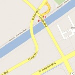
There are entrances are on both sides of Lincoln Boulevard but no parking. To the north, Lincoln Boulevard is at present not a bike-friendly street; to the south, however, there are bike lanes that connect Ballona Creek with Loyola Marymount University up the hill (not recommended for youngsters).

